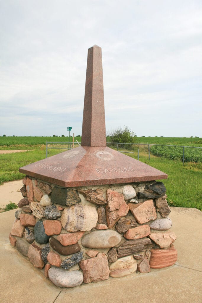
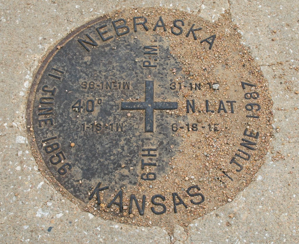
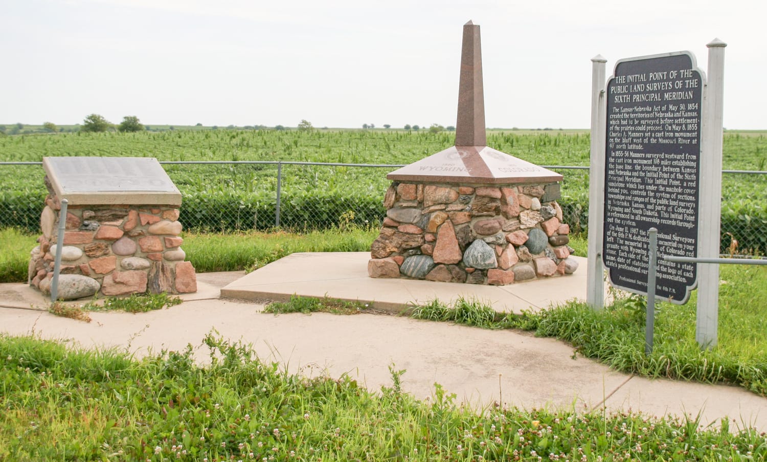
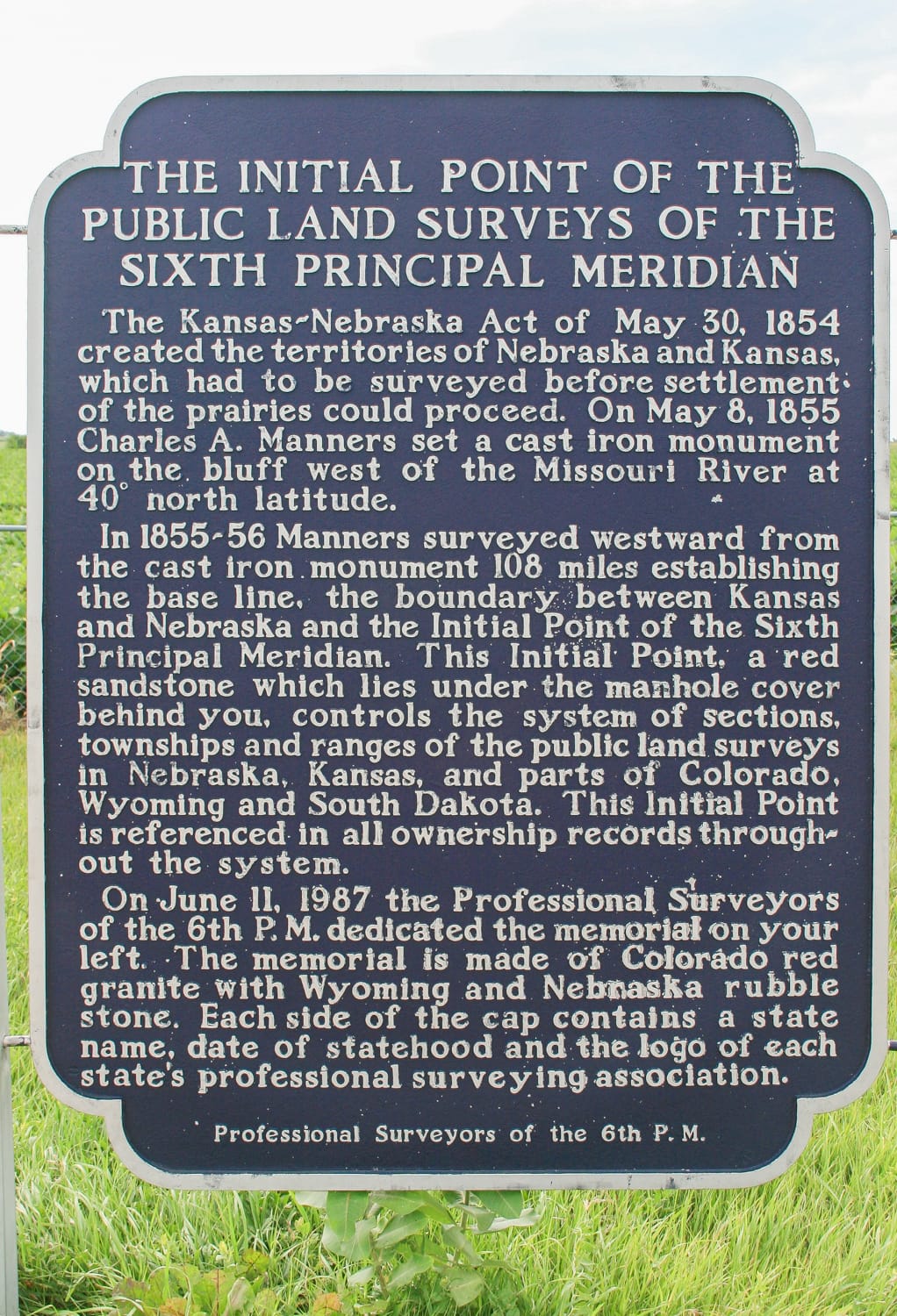
The Initial Point for all land surveys in Kansas, Nebraska, much of Colorado and Wyoming, and a small part of South Dakota was marked on this site in 1856. The survey, which created the Sixth Principal Meridian (40th Parallel), resulted from the congressional decision on May 30, 1854, to establish and survey Kansas and Nebraska Territories. From this Initial Point more than 200 million miles of land were surveyed. Today the survey point is marked with a plate (manhole cover) in the middle of the road. Nearby, monuments and an informational marker tell the intriguing story surrounding the survey. (NRHP)
Sign in or join to save this attraction and track your Kansas adventures!
Sign In or JoinAt this 1953 diner with carhop service and die-hard fans,...
Dr. Walter Bartlett started the arboretum in 1910, and it...
Hop on this old rail trail for a smooth, mostly...
You can taste the difference in every bite when the...