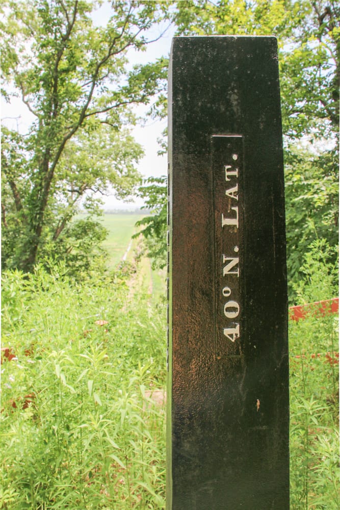
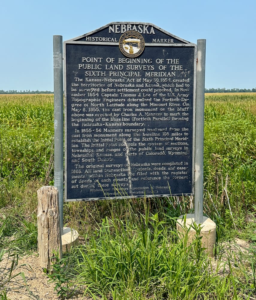
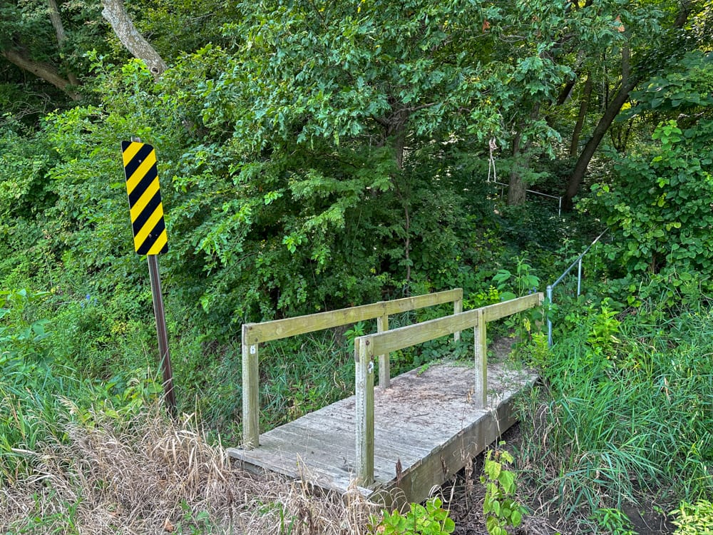
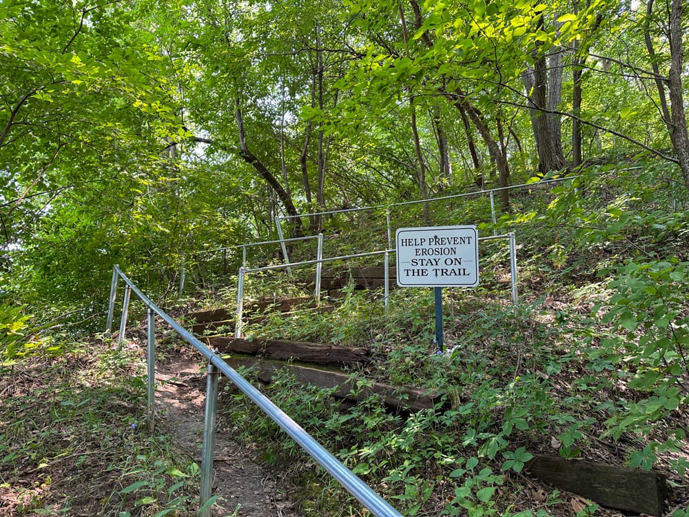
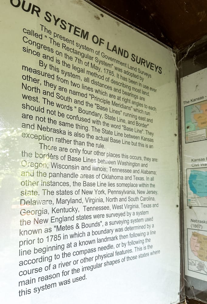
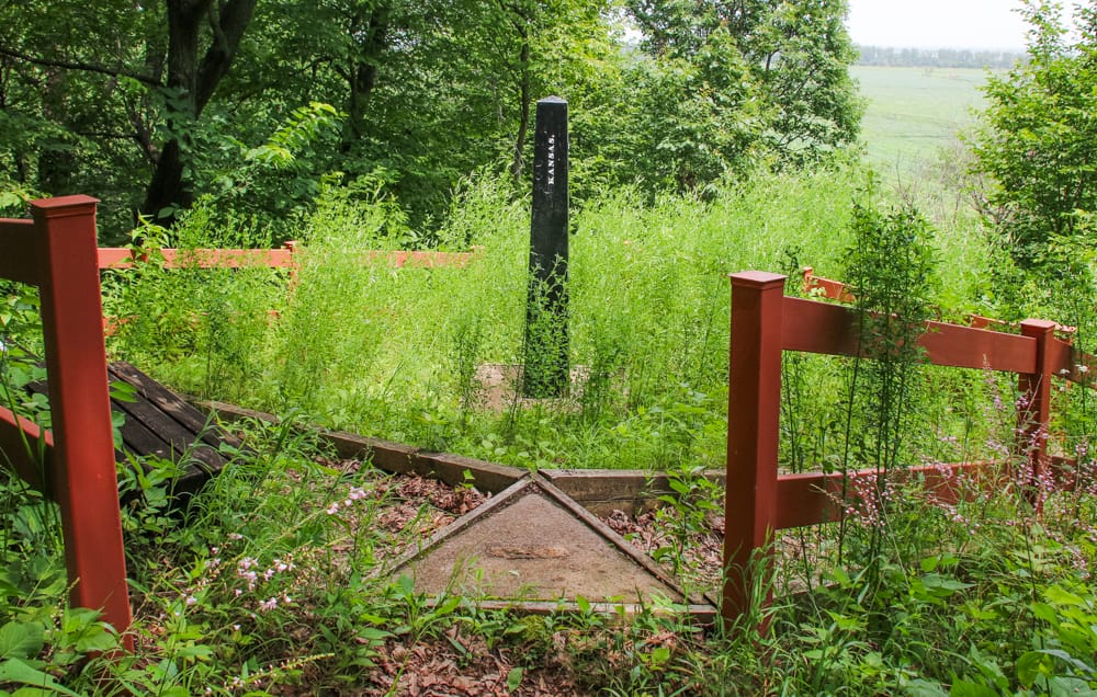
Stop here to read the historical marker that relates the story of the Public Land Surveys of the Sixth Principal Meridian. From here, another 120 yards north on K-7 a little footbridge leads to a path that takes you 150 feet to the top of the bluff (handrails help navigate the steep grade). At this hilltop you'll see the cast iron monument erected in May 1855 by U.S. Deputy Surveyor Charles Manners to mark the beginning point of the 40th Parallel—the border between the future states of Nebraska and Kansas.
Sign in or join to save this attraction and track your Kansas adventures!
Sign In or JoinAn old body shop has a new look with added...
Road trips deserve coffee this fresh. Sitting at the corner...
Keep your eyes open as you drive around Anthony as...
Get close enough to appreciate Bigfoot's size—and don't worry, he's...